Construction of hydrostratigraphic architectures from a large well log dataset
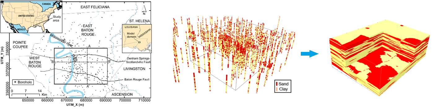
(left) Map of the study area and boreholes; (middle) distribution of sand and clay segments in boreholes as the result of well log interpretation; and (right) hydrostratigraphic architecture at 1-foot vertical resolution.
|
|
|
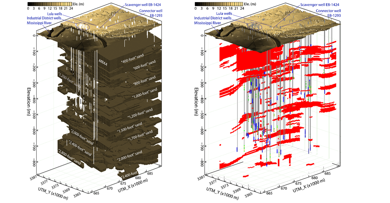
Hydrostratigraphic architecture for the Baton Rouge aquifer systems reconstructed at 1-foot vertical resolution.
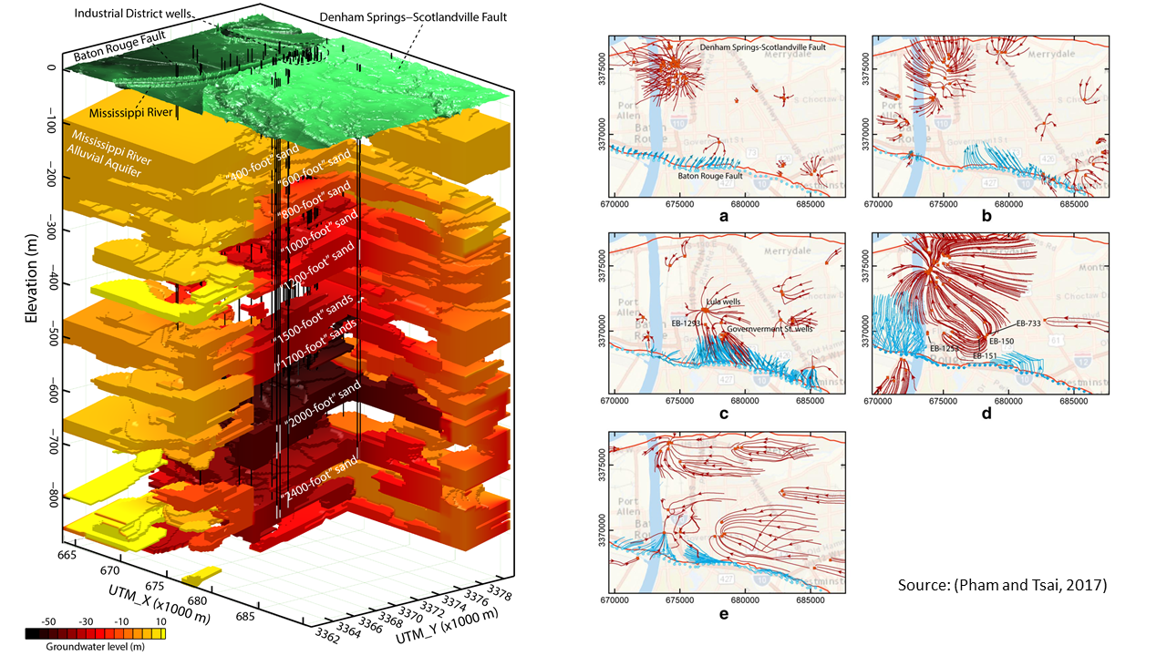
Conceptual groundwater model for the Baton Rouge aquifer system, including 11 aquifers, two geological faults, and pumping and injection wells (Pham and Tsai, 2017).
Software: ArcMap, GMS, MFGRID and Tecplot.
Modeling of groundwater flow and salt water intrusion
Changes in groundwater levels during the 1975-2010 period in the “1500-1700-foot” sands of the Baton Rouge aquifer system.
|
|
|
Modeling saltwater intrusion toward a water supply well. Numerical models: MODFLOW and MT3DMS. Software: GMS.
Modeling of groundwater flow and particle tracking
(left) Conceptual groundwater model for the Baton Rouge aquifer system and simulated groundwater level in December 31, 2014 in 11 aquifers. Clay facies are blanked. Vertical lines are pumping wells with screens (white segments); and (right) forty-year particle tracking simulations from January 1, 1975 to December 31, 2014. Squares are pumping and injection wells. Red lines and blue lines represent backward tracking and forward tracking of particle traces, respectively.
Modeling of groundwater flow and transport in a fractured aquifer using discrete fracture network modeling (DFN)
|
|
|
Modeling a real-world case study of pumping and tracer tests in three-dimensional discrete fracture networks (DFN): (left) a plan view and (right) a cross section view. Tracers are released at the injection well #1 and pumping is at well #3. Numerical models: dfnWorks, dfnWel; Visualization: ParaView.
|
|
|
Tracking particle into a pumping well (in middle of domain) in a 3-D DFN where initial particles are equally distributed over a sphere: (left) fracture network generation, and (right) particle tracking. Numerical models: dfnWorks, dfnWel; Visualization: ParaView.
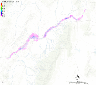
Modeling stream capture caused by groundwater pumping
|
Study the effects on surface water depletion caused by groundwater pumping for the upper Humboldt River after 1, 5, 10, 25, 50 and 100 years . A hypothetical pumping rate of a 20,000 ft3/day was used.
|
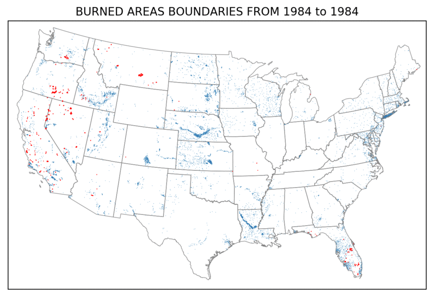
Groundwater-wildfire interactions
|
|
|
|
Using groundwater and fire data from across the United States to explore connections between the two, namely how groundwater levels may be affected by wildfire activity and how fire may impact the amount of water that infiltrates the soil and replenishes groundwater supplies. Identifying these relationships will play a critical role in enhancing both fire predictions and groundwater resource management.
|
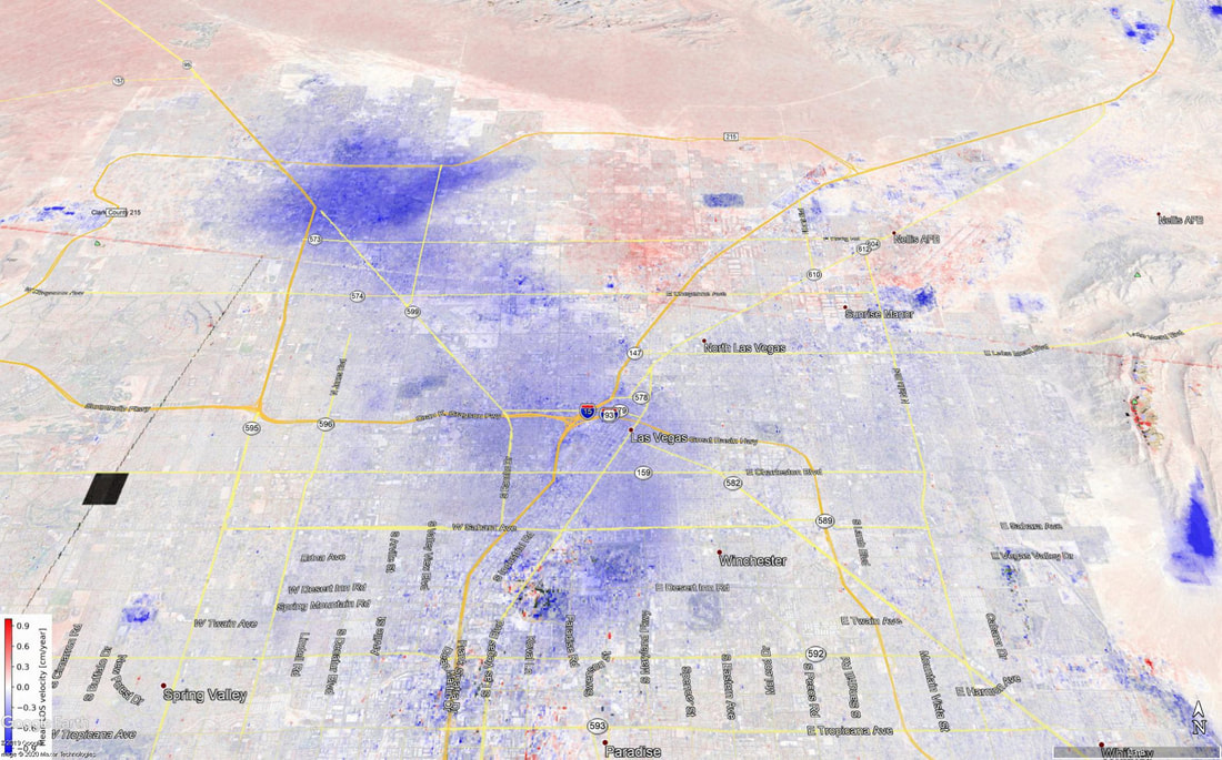
Groundwater Availability in Niger
|
|
|
|
